The site has changed; the significance remains.
 |
|
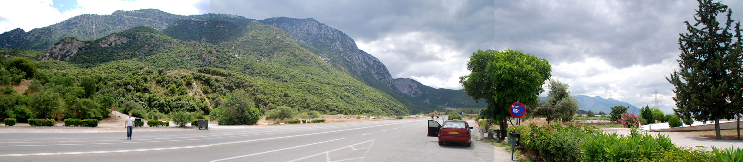
A view of the pass, roughly as the Spartans would have seen it, facing north, facing the Persians coming down the path towards you. (The Spartans were likely posted up and to the left on a path in the low hills as the sea was closer to this road.) In 480 BC, a crucial battle took place here - a battle that has entered myth and legend. It was a defeat, but a defeat that led to victory. I will not recount the story here, there are many books that do that. I will instead focus on the geography of the site. In the photo above, on the left, behind the person in the light shirt is the path that leads up to the burial mound. On the right of the photo is the start of the monument to the allies that fought with Sparta here. Behind and to the right of the photo is the main battle monument. |
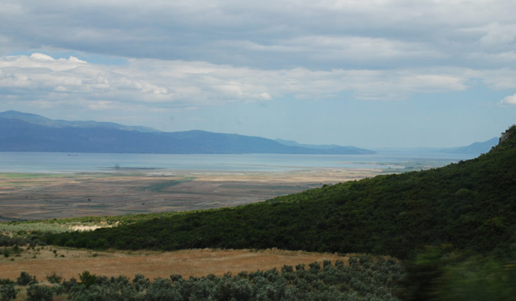
We have to start with geography. Here, in the photo at right, is a view looking north of the Maliakos Gulf. Lamia, and the mouth of the river is to the left. Thermopylae is down to the right.
In ancient times the coast line was much closer to the hills. Over 2500 years silt has come down from the river and deposited here, creating a wide shelf. There is a dispute about just how much closer the coast line was in the past..
The myth that the path was only feet wide and Persians could fall down a cliff into the water is not going to fly. Remember that for most of the battle, there were 7,000 fighting on the Greek side, not 300, so a wider front makes sense. Apparently there is marshland near the coastline and it might have been that way in antiquity also. So heavily armed Persians could sink into the marsh.
So, Herodotus is right, just not in the way we thought.
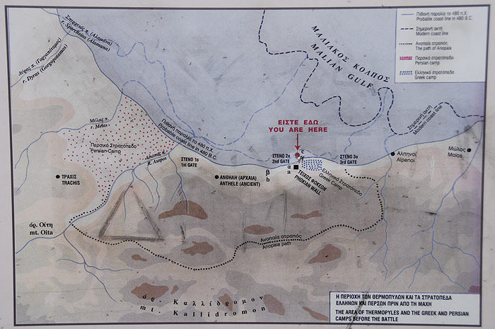 This sign, at the site, lays out the battle situation. Note the estimate of the original coast line and the path for going around the defenders.
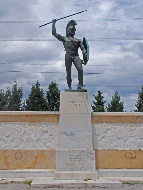
There are two monuments on the north side of the road (to the right of the road in the first photo on the page).
This monument remembers the Spartans.
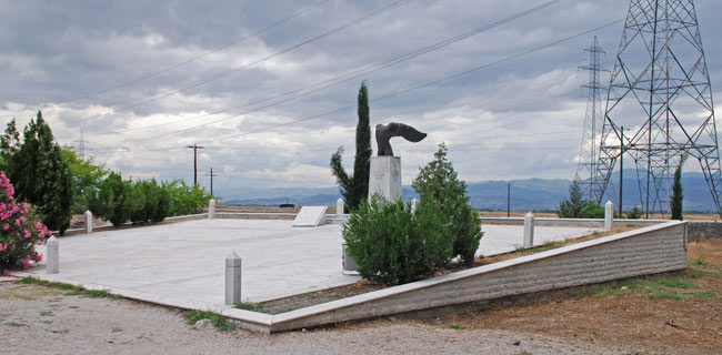 This monument commemorates the allies.
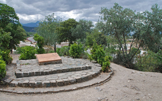
On the south side of the highway is the burial mound for the Greek dead. It can be climbed by that dirt path you can see.
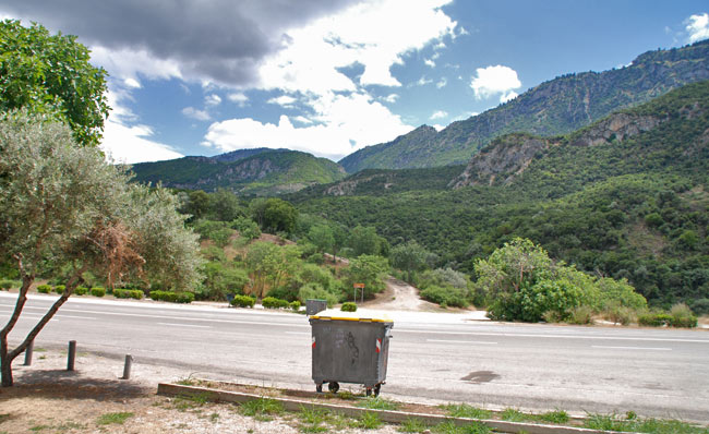
(Sorry for the presence of the dust bin.)
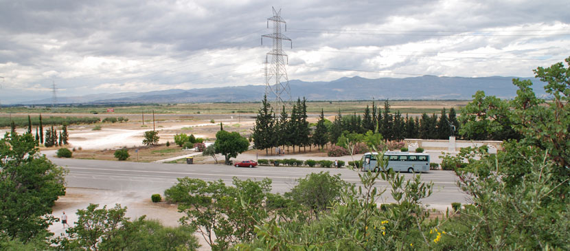 From on top of the burial mound, you get another view of the monuments on the north side of the road. The allies monument is just visible in the left center (from the path leading from the highway) and the main monument is above and to the right of the bus.
Here is a plaque with the famous epigram of Simonides.
(This, of course, is a modern reconstruction)
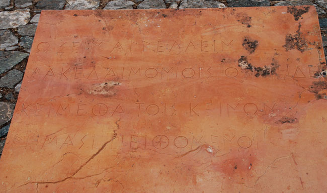
It is translated in various way, I like this:
Oh Stranger, tell the Lacedaemons, you who read;
Obedient to their orders, we lie here dead.
Laconic, so to speak. And not bitter, but faithful to the demands of honor.
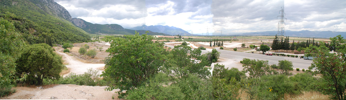 |
| A second panorama, taken from on top of the burial mound. |
| Last modified 2/19/19; posted 6/19/09; original content © 2019, 2009 John P. Nordin |